- Home
- Internet
- Internet News
- Google to add Galapagos Islands to Street View
Google to add Galapagos Islands to Street View

Google has followed in the footsteps of Charles Darwin to gather images of the beauty and biological diversity of the Galapagos Islands for the Internet titan's online maps.
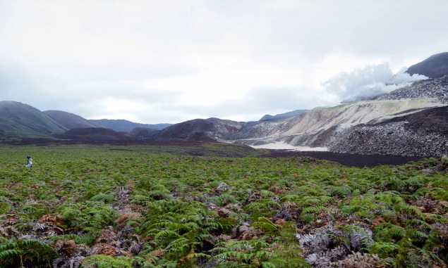
A Google Maps team toting 360-degree cameras sticking from backpacks hiked trails, hills, and even into a live volcano to take Street View pictures of the precious environment where Darwin gleaned insights for his theory of evolution.
"We were in a boat on choppy waves; clambering over lava rocks, and on horseback up the side of a volcano," Google Maps project lead Raleigh Seamster told AFP on Thursday.
"There were a lot of adventurous times. It was very inspiring."
The Street View team spent 10 days on the islands working with the nonprofit Charles Darwin Foundation (CDF); Galapagos National Park Directorate, and Catlin Seaview Survey.
The CDF had reached out to California-based Google to add images from the Galapagos Islands to Google Maps to let people virtually explore without treading on the fragile ecosystem and as resources for research and education.
"This is a unique opportunity to spearhead technology science for conservation and public awareness about the importance of Galapagos ecosystems in a changing world," CDF head of research on human systems Daniel Orellana said in a release.
Catlin Seaview Survey used special photography gear to collect high-definition, panoramic images in the waters of the archipelago, which is listed as a United Nations World Heritage Site.
"We have compiled an amazing portfolio of 360-degree images that will allow the world to take 'virtual dives' in the Galapagos Marine Reserve's unique ecosystems," said Darwin Foundation head of fisheries Pelayo Salinas de Leon.
Underwater images will also be used as baselines for gauging the health of the marine system and the effect of climate change.
Google engineers are weaving imagery into immersive Street View scenes that will be added to its free online mapping service later this year, the company said in a blog post Thursday describing the project.
"They picked a very diverse set of places, from some that tourists visit quite often to locations that are off-limits," Seamster said.
"We had to hike across four kilometers of lava fields to get to a spot where land iguana restoration was going on," she continued.
"We were able to get very close to animals."
The project marked the first collection of Street View images in Ecuador, according to Google, which has ranged to places such as the Amazon in Brazil and the Canadian Arctic to get pictures for online maps.
For the latest tech news and reviews, follow Gadgets 360 on X, Facebook, WhatsApp, Threads and Google News. For the latest videos on gadgets and tech, subscribe to our YouTube channel. If you want to know everything about top influencers, follow our in-house Who'sThat360 on Instagram and YouTube.
Related Stories
- AI
- iPhone 16 Leaks
- Apple Vision Pro
- Oneplus 12
- iPhone 14
- Apple iPhone 15
- OnePlus Nord CE 3 Lite 5G
- iPhone 13
- Xiaomi 14 Pro
- Oppo Find N3
- Tecno Spark Go (2023)
- Realme V30
- Best Phones Under 25000
- Samsung Galaxy S24 Series
- Cryptocurrency
- iQoo 12
- Samsung Galaxy S24 Ultra
- Giottus
- Samsung Galaxy Z Flip 5
- Apple 'Scary Fast'
- Housefull 5
- GoPro Hero 12 Black Review
- Invincible Season 2
- JioGlass
- HD Ready TV
- Laptop Under 50000
- Smartwatch Under 10000
- Latest Mobile Phones
- Compare Phones
- HMD Pulse
- HMD Pulse+
- HMD Pulse Pro
- Realme Narzo 70x 5G
- Realme Narzo 70 5G
- Samsung Galaxy C55
- Blackview Hero 10
- Oppo K12
- Lenovo IdeaPad Pro 5i
- Asus ZenBook Duo 2024 (UX8406)
- Realme Pad 2 Wi-Fi
- Redmi Pad Pro
- boAt Storm Call 3
- Lava ProWatch Zn
- Samsung Samsung Neo QLED 8K Smart TV QN800D
- Samsung Neo QLED 4K Smart TV (QN90D)
- Sony PlayStation 5 Slim Digital Edition
- Sony PlayStation 5 Slim
- Lloyd 1.5 Ton 3 Star Inverter Split AC (GLS18I3FOSEW)
- Haier 1.5 Ton 3 Star Triple Inverter Split AC (HSU18K-PYSS3BN-INV)


